About
About  RFQ
RFQ  Resources
  Contact
  News & Media

The Confluence Sandy River Park & Trail
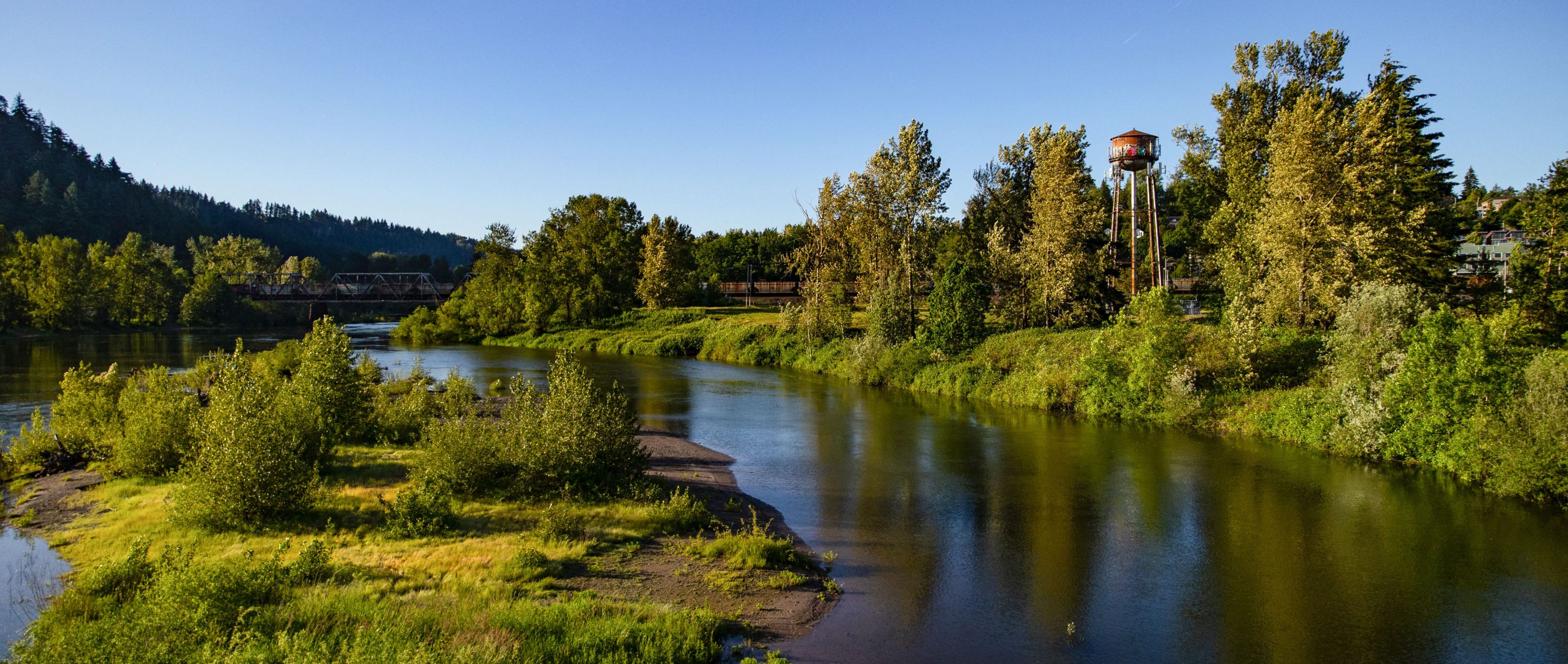
The City of Troutdale is completing design and engineering work on a 3.5 acre waterfront park and trail along the Sandy River on the The Confluence at Troutdale site. Once complete, the trail will close a gap in connecting downtown Troutdale with the regional 40 Mile Loop trail system and the existing trail along the I-84 bridge connecting to the Sandy River Delta Natural Area and Lewis & Clark State Park. The trail and park will also complement future private development efforts in the Urban Renewal Area.
Project History
 2014 - Sandy River Access Plan
In 2014, the City, in partnership with Metro, developed the Sandy River Access Plan, which created the template for proposed waterfront park and trail to better connect Troutdale residents and visitors with one of our most iconic natural assets, the Sandy River. In doing so, park and trail investment would coincide with private development that works well with the surrounding area. This document can be found below.
2019 & 2020 - 30% Design
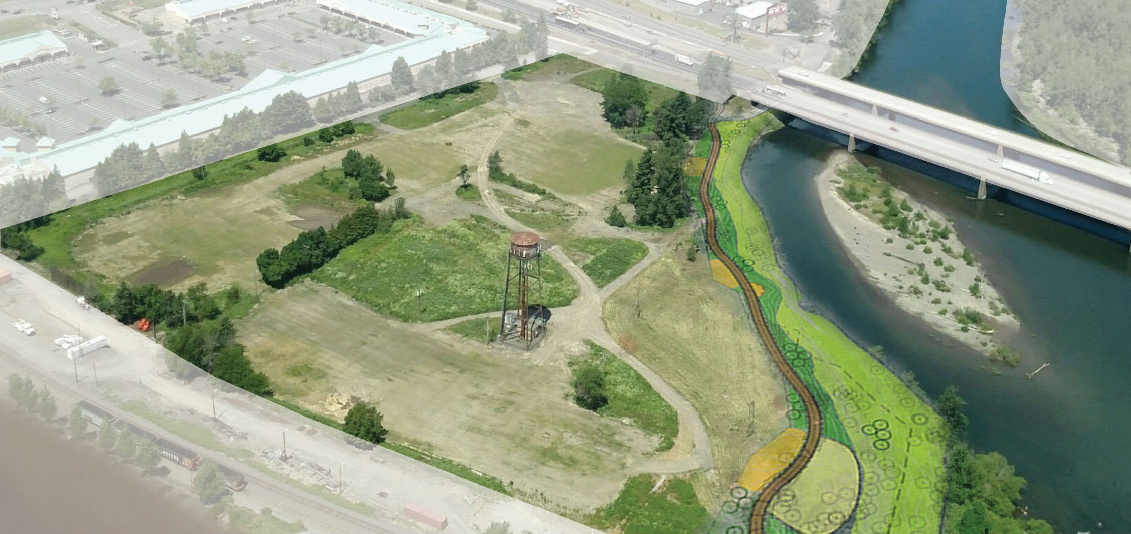
In October 2019, an open house on trail and park design concepts was held, with about 50 attendees offering feedback. From that feedback, the City worked with MZLA and Firwood Design Group to establish a 30 percent design of the park and trail.
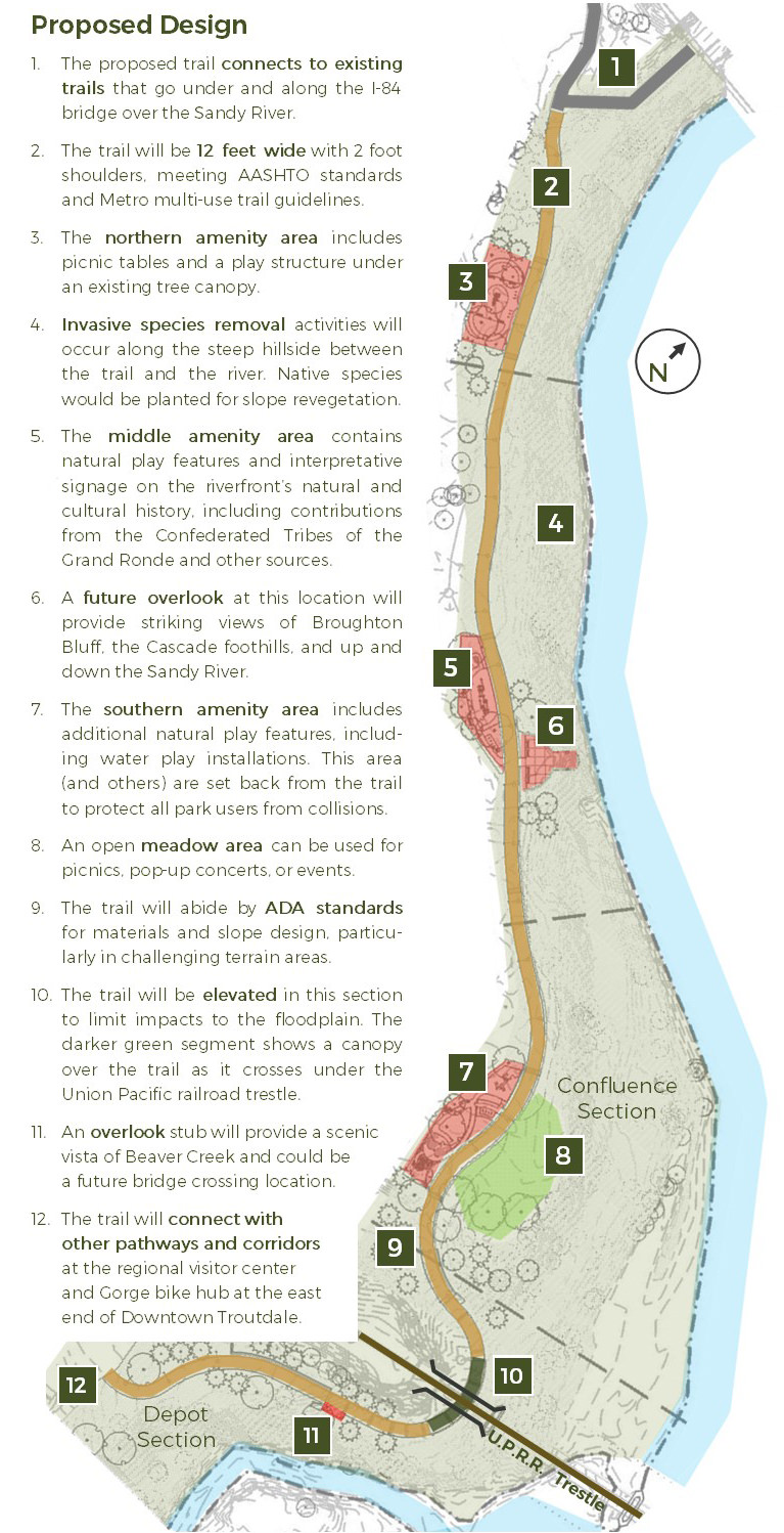
The design calls for a minimum 12 foot wide trail that connects with the existing trailhead to the I-84 bridge in the north with the currently improved trail in Depot Park to the south. It also calls for an elevated section that will go underneath the Union Pacific Railroad tressle. The path will need to be elevated in this area to accommodate for allowable slope ratings for ADA compliance and to have minimal interference with natural floodplains in this area.
The park that is envisioned will be linear in nature and would feature three main areas of congregation, including the possibilities of play equipment for kids and a gathering area for picnics and events. Efforts to maintain significant trees already on site and to introduce new trees were also addressed.
2020 to 2022 - 60% & 90% Design
The City has completed the design phases for the trail, with the 90 percent designs finalized in October 2022. A multi-year invasive species removal program, initiated as part of the project, has achieved remarkable success. Large areas previously overtaken by blackberry and English ivy have been restored to support native vegetation and improved ecosystem health along the trail and its embankments.
The City secured funding for the project, receiving grants from Metro and Oregon State Parks. This financial support has been instrumental in bringing the trail closer to completion, ensuring high-quality design and community value. Below are the full 60% design plans and an illustrative for the 90% design.
2024 - 2025 - Construction of the Trail
The City officially broke ground on the Sandy River Park & Trail on October 10, 2024 - the same days as the official ribbon cutting for the Ch’ak Ch’ak Trail. The Sandy Riverfront trail is expected to be completed in the summer of 2025.
Supporting Documents
2014 - Sandy River Access Plan Final Report (19 MB)
Sandy Riverfront Trail - 60% Civil Plans (31 MB)
Sandy Riverfront Trail - 60% Structural Plans (6.8 MB)
Sandy Riverfront Trail - 60% Civil & Landscape Specs (275 KB)
Sandy Riverfront Park - 90% Site Plan (7 MB)